Farm Monitoring Drone

One flight over the farm, one map of everything that needs attention

Current project ยท Building with a partner farm
Back to Engineering Projects

Project Overview

I'm leading a student team building an all-purpose agricultural drone. It flies over a farm, collects camera and LiDAR data, and turns it into a field heatmap the farmer can actually use: where pests are showing up, how crops are growing, and how much fruit is on the trees.

The idea grew out of my pest-detection work at Owl Vision and a list of problems a farmer I work with wanted solved. We've partnered with a farm and are designing the drone alongside its farmers so it fits how they really work.

Long term, flying the same drone across many farms and seasons builds a crop-health dataset that no single farm could collect on its own.
System Architecture

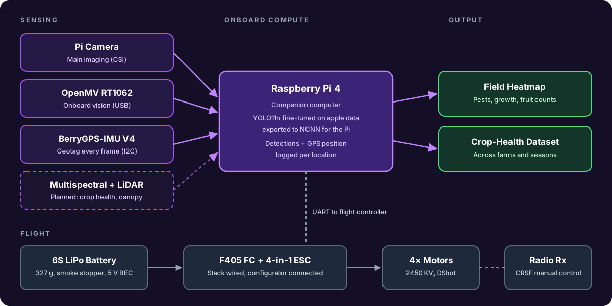
A Raspberry Pi 4 rides onboard as the companion computer. It runs detection on a Pi camera, with an OpenMV RT1062 as a second onboard vision module, and a BerryGPS-IMU tags every frame so results land in the right spot on the map. Multispectral imaging and LiDAR for canopy and fruit density are the next sensors on the roadmap.

System diagram of the farm monitoring drone: sensors feed a Raspberry Pi that outputs a field heatmap, with a separate F405 flight stack
System block diagram

First Model: Counting Apples

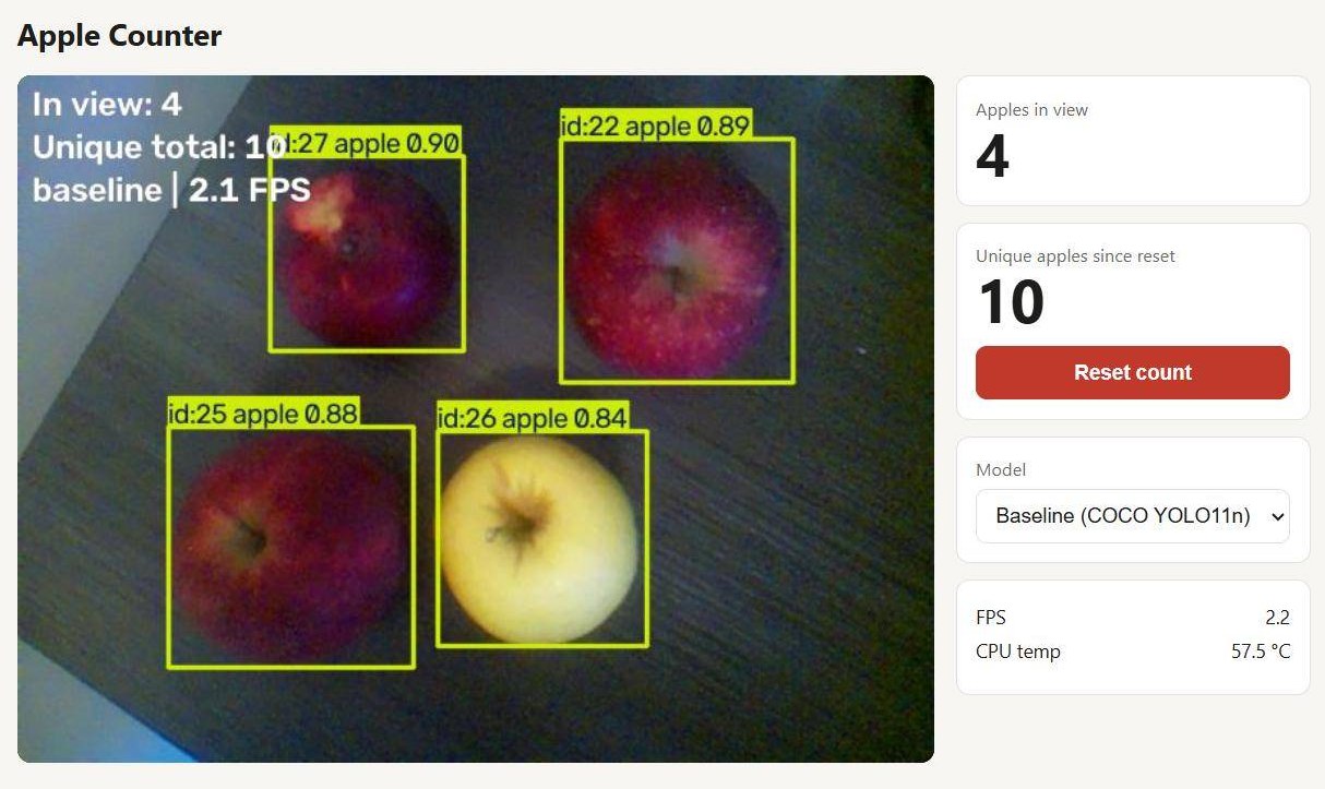
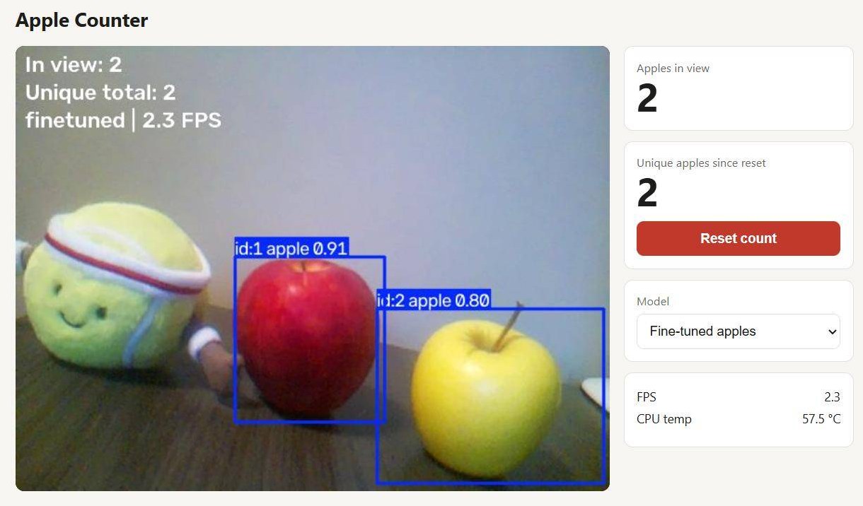
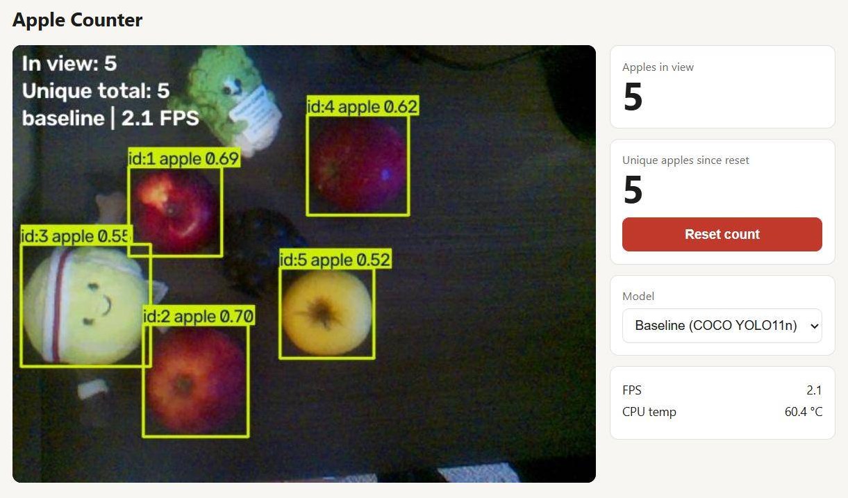
The first detection task is counting apples. I built it as a tabletop demo on the Raspberry Pi 4 and camera, with a live dashboard that shows apples in view, a running count of unique apples (each one gets a tracking ID so it is only counted once), the active model, frame rate, and CPU temperature.

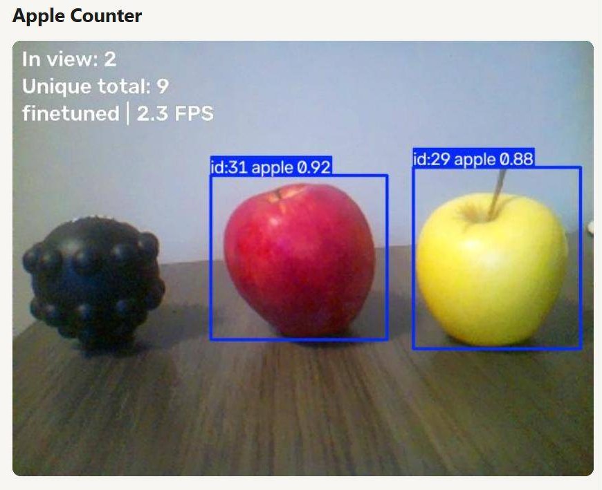
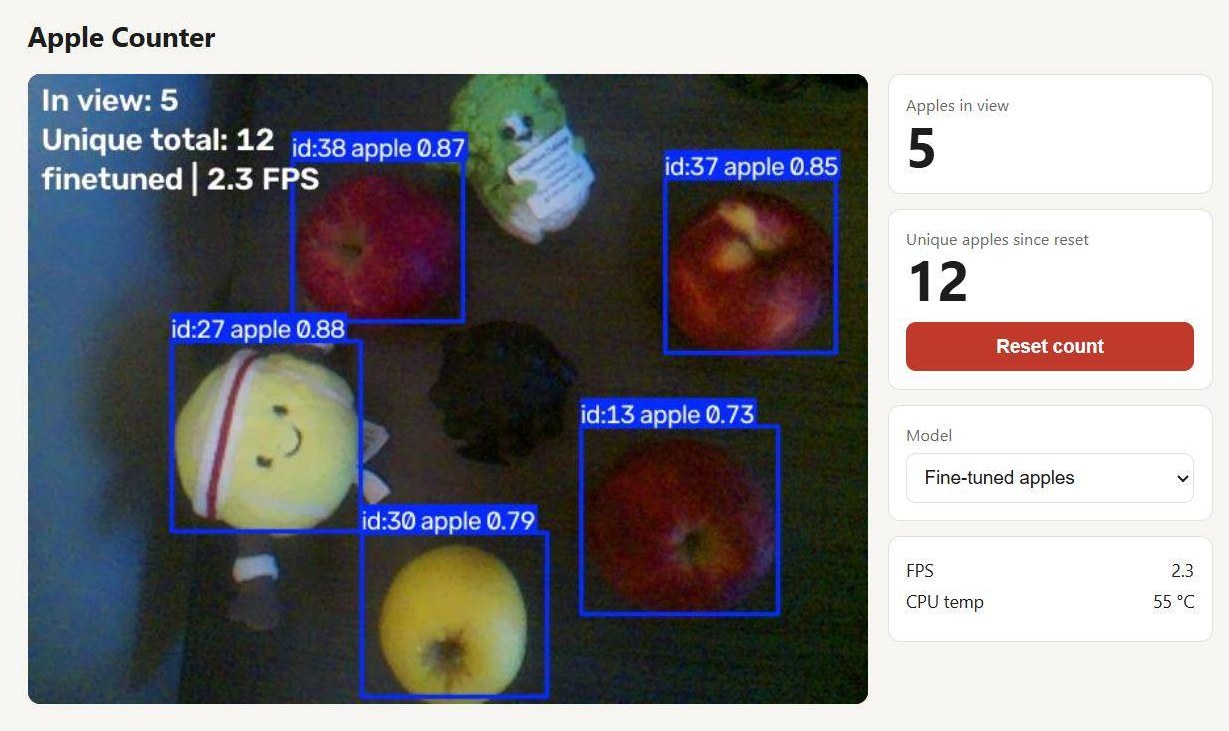
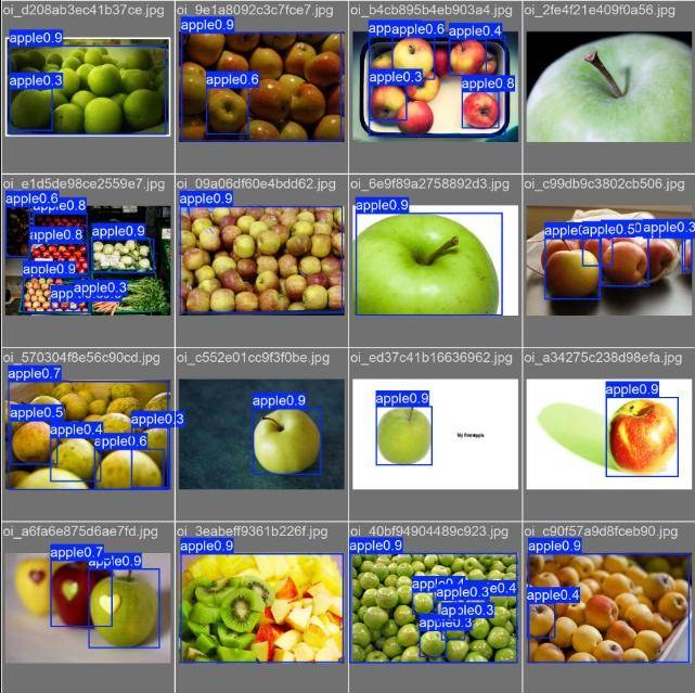
The stock COCO-trained YOLO11n found apples, but with confidence only around 0.5 to 0.7, and it happily labeled a tennis ball plush as an apple. To fix this I fine-tuned YOLO11n on public apple datasets in Google Colab and exported it to NCNN so it runs on the Pi at about 2 FPS.

YOLO11n
Fine-tuned on public apple datasets
0.73 to 0.92
Detection confidence after fine-tuning
NCNN
Exported for on-device inference

Before: baseline COCO model

After: fine-tuned on apple data

Flight Hardware

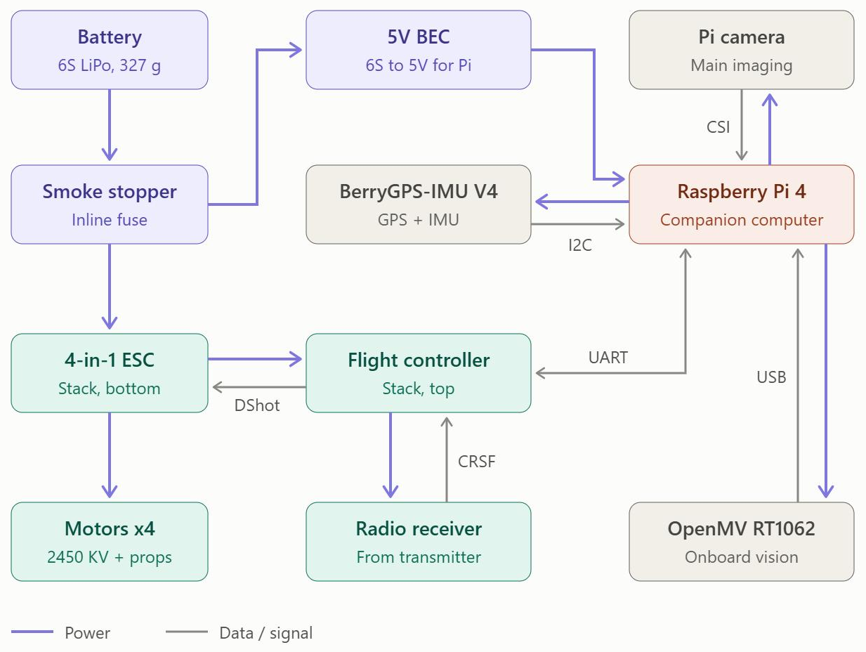
The flight side is kept separate from the sensing computer. A 6S LiPo feeds an inline smoke stopper, then the Aero Selfy F405 flight controller and 4-in-1 ESC stack driving four 2450 KV motors over DShot. A 5 V BEC powers the Pi, which talks to the flight controller over UART, and a CRSF radio receiver handles manual control. The stack is soldered, wired, and connected to the configurator; next up is choosing flight firmware, with ArduPilot as the front runner for GPS waypoint missions.

Drone electrical diagram showing battery, smoke stopper, BEC, ESC, flight controller, radio receiver, Raspberry Pi 4, Pi camera, BerryGPS-IMU, and OpenMV RT1062
Power and data wiring for the drone

Next Steps

  • Move apple counting from the tabletop to real trees, recording fast footage and processing it afterward
  • Integrate multispectral imaging and LiDAR on the Pi
  • Pick flight firmware and airframe, then fly first survey missions over the partner farm
  • Generate the first field heatmap for the farmers to review